Art Loeb Trail and Cold (Hearted) Mountain
“The 30.1 mile Art Loeb Trail is one of the longer and more difficult trails in the state, and it's also one of the more popular.” (source)
“The very steep and rugged terrain of the Shining Rock Wilderness includes five mountains that rise above 6000 feet. At 6030 feet, Cold Mountain is the highest point in the Wilderness...Almost all the trails in the Shining Rock Wilderness are rated as difficult. Additionally, some of the trails can be hard to follow in some places. Hikers should bring a good detailed map with them before venturing into the wilds.” (source)
“The challenging Art Loeb Trail is a 30-mile trail located in Pisgah National Forest…” (source)
“...iconic trail...epic views...a must do on the life list of all Appalachian hikers...If you are a glutton for punishment you will enjoy every steep step up Pilot Mountain…” (source)
No kidding!
If you do a Google search for “Art Loeb Trail” you’ll find all sorts of blog posts by people who decided to go on a hike or a trail run in the wilderness and totally got their butts kicked. This blog post is no exception.
Oh sure, I had my handy mini map with elevation profile and data points. I also had my detailed NatGeo map for the nefariously ill-marked section of trail in the Shining Rock Wilderness. I made sure I had been hiking and running recently so I was fairly fit, and I also brought a ridiculous amount of water. Even so, we still got lost, we almost ran out of water, and now, a few days post-trek I spent most of the day convinced my decimated and sore legs would just fall off me where I sit.
Cliche meme? Fine, but in this case it’s totally appropriate.
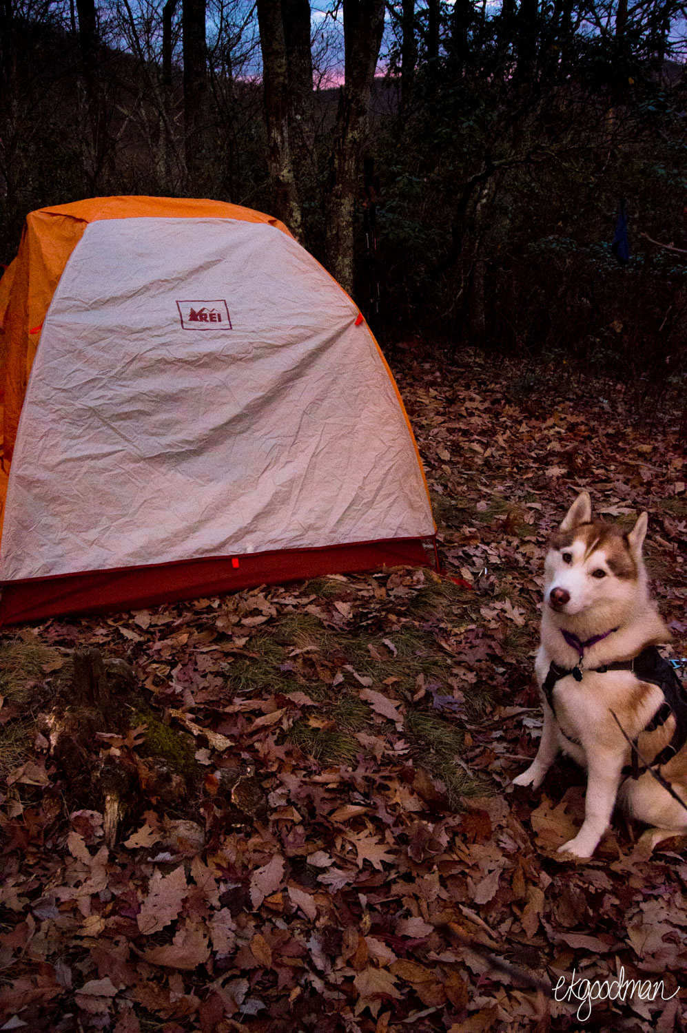
When we were finally situated and hiking up the first steep incline away from the parking area next to the roaring Little East Fork Pigeon River just past a boy scout camp, it was after 4:30pm on Thanksgiving, meaning we had pittance for daylight for our hike in. We arrived at a campsite after dark and enjoyed Thanksgiving dinner of instant potatoes, instant stuffing, chunk chicken in a pouch, and instant turkey gravy by the light of our headlamps.
Through the long, cool night and with Ryder sweetly snuggled up between McCrae and me I had one of my best backcountry sleeps in my life so far. It was either the lullaby of the wind whistling over Cold Mountain looming above us or just the fact that we had a level and rock-free site for our tent that contributed to my blissful slumber, but I awoke ready for some warm biscuits and gravy and a solid day of hiking.
At least, I thought I was ready, but a 700+ foot climb over a mile with a slightly overburdened pack (it was festive! extravagant! ambitious! unnecessary!) meant aching knees, burning calf muscles, and lungs gasping so hard for air I couldn’t speak. Art Loeb may have taken up hiking after a heart attack in his 40s, but his famous trail was about to give me a heart attack in my 20s! Bumped, bruised, scraped, dirty, and hungry, we finally climbed into a clearing with one busted trekking pole to boot.
Hehe. Ryder giving McCrae bunny ears as he looks at the map.
“Do you reckon this is Deep Gap?”
“I think so. It looks like a gap.”
“Yeah, but we’re supposed to intersect with a spur trail to the top of Cold Mountain around here.”
“How long is the spur trail?”
“1.4 miles one way.”
“We’re running behind schedule already. Otherwise I’d say we do it.”
“Yeah, agreed. Let’s just keep moving.”
“Okay. So...which direction?”
“It’s wilderness, so none of the trails are maintained or marked.”
“So…”
“So...uhm…”
“That way?”
“Sure.”
I know, I know! “Liz, why didn’t you check the map?!” Because I’m an idiot, duh, and that direction looked like the only reasonably well-trodden trail.
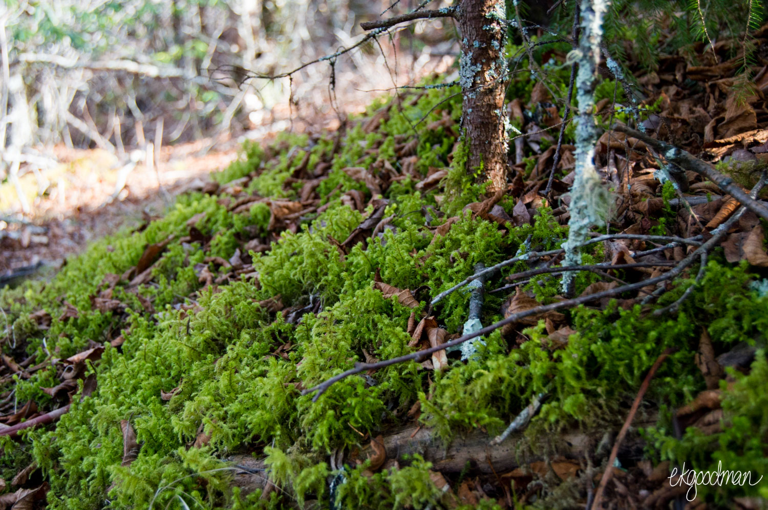
Yeah, that’s the last time I’m taking anything in the wilderness for granted. We’d barely suffered through a quarter mile of steep climbing and hadn’t seen any reassuring white blazes before Ryder scrambled off the trail and lay down, insisting on a respite. I didn’t blame him, and we wallowed in some moss for a few minutes.

“I think this is the Cold Mountain side trail.”
“I think so too.”
“But I didn’t see anything else that looked like an established trail, did you?”
McCrae shed his backpack and backtracked to the gap to scout out other possibilities, but found nothing definitive. No signs. No white blaze. Nada. So we kept climbing.
Ryder getting camera shy. "Seriously, Liz, take a picture of something else for a change."
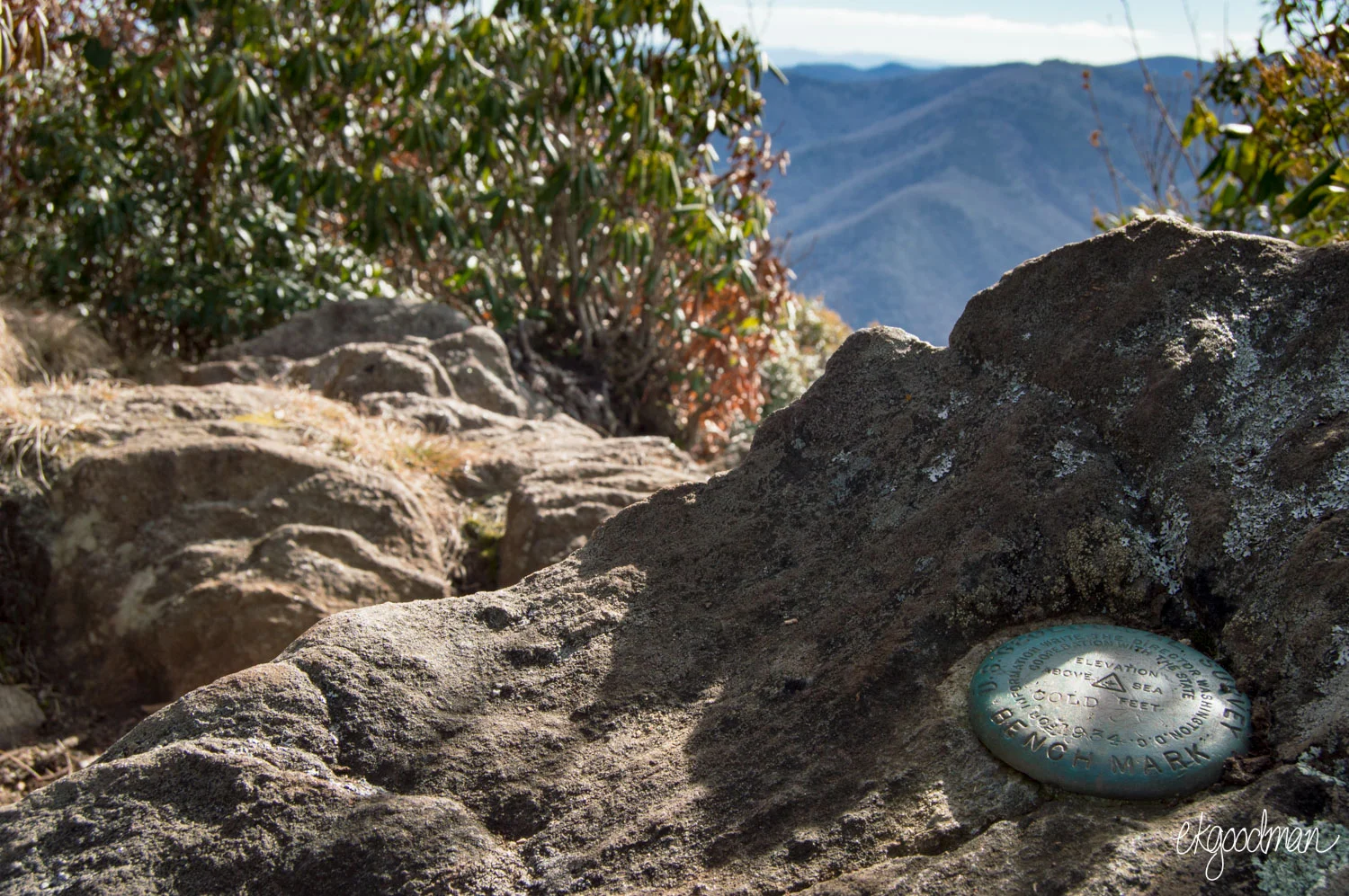
Eventually we reached the summit. Yup. Cold Mountain, the very same of the award-winning book and film. It was breathtaking in terms of views and hikes, and despite our gaffe McCrae and I stayed for a while, exploring various rock ledges and crannies and snapping photos of the surrounding area, including, to the east, Mt. Pisgah.
U.S. Geological Survey: Cold Mountain marker.
“Well, there’s no way we’re going to finish all 30 miles of the Art Loeb Trail this weekend now.”
“Nope. Want to just head on back?”
“Sure.”
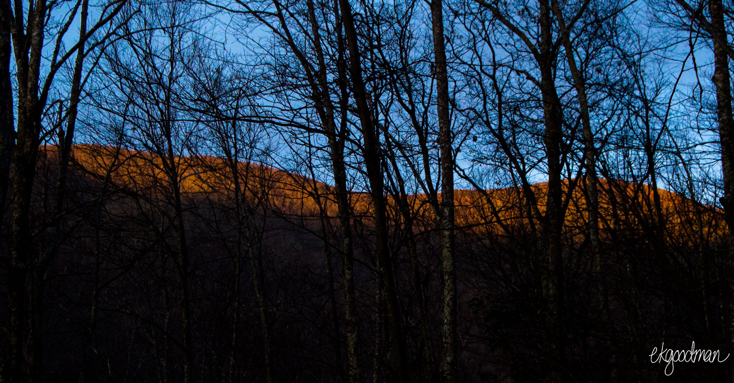
And that was that. Well, that, and Ryder dragged me off the trail and down the steep side of the mountain where, cursing, I floundered in a flurry of rotting leaves and musky galax. That, and the second night I spent in the shadow of Cold Mountain I watched the sun slip over the horizon, casting a rosy alpenglow on Cold Mountain’s substantial summit.
“I don’t care what anyone says,” I said later when recounting my (mis)adventure to a friend. “I know there are mountains out West that make Cold Mountain look like a molehill, I know. But even so, Cold Mountain is a massive mountain.”
As for the Art Loeb Trail? Well, it will still be there come my next long weekend that I have free. Of course, next time I’ll pack a lighter pack, will have more wits about me, and will do some intense stadium runs in my regular running schedule. Hey, Kenan Stadium, when are you free again for a running date?
Hey, Kenan Stadium! I'm ready for a stadium run whenever you are. I hear the football team isn't using it right now.